Construction drone monitoring for progress tracking
Construction drone monitoring is the use of unmanned aerial vehicles to capture visual data on construction sites at regular intervals, enabling project teams to track progress over time. This practice relies on scheduled flights, image processing, and comparative analysis to produce records that show how a site changes between visits. It is applied across residential, commercial, infrastructure, and industrial projects, where keeping a reliable timeline of physical changes supports planning, communication, and documentation.
How progress tracking works with drone captures
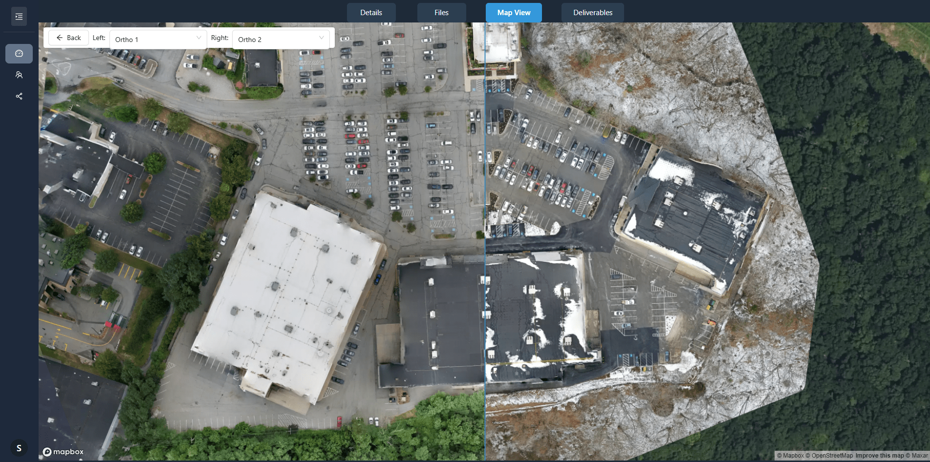
Progress tracking through drone captures depends on repeated flights over the same site. A project team defines a flight plan that covers the entire construction area, often at a consistent altitude and angle. The drone captures overlapping images that are later stitched into an orthomosaic - a geometrically corrected aerial photograph that preserves true scale and position. Each flight date produces a new orthomosaic, and by comparing these layers, project managers can see which areas have advanced and which have stalled.
Change detection software highlights differences between captures. It can mark new structures, removed material, or altered ground surface. Some platforms also allow site annotation, where a user draws on a capture to mark completed sections or flag issues. The combination of orthomosaics, change detection, and annotation creates a visual record that complements written reports and blueprints.
One such platform, nationaldroneservices.net, processes and organizes aerial imagery so that project teams can view and compare captures side by side. This kind of system makes it possible to track progress without visiting the site daily, reducing travel time and improving the frequency of updates.
Types of drone data used in construction monitoring
Different types of drone data serve different tracking needs. The most common are orthomosaics, digital surface models, and point clouds. Each captures a different aspect of the site.
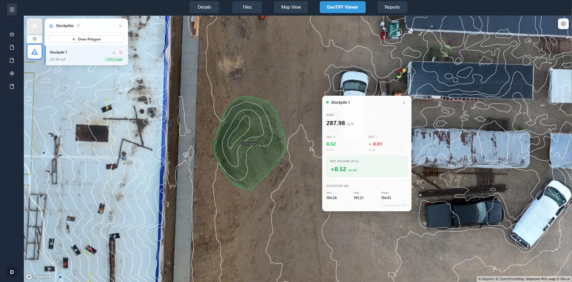
- Orthomosaics: high-resolution, georeferenced images that show the entire site in a single composite. They are useful for measuring area, counting objects, and comparing visible changes.
- Digital surface models (DSMs): elevation models derived from drone images. They show the height of structures, stockpiles, and terrain. Comparing DSMs from different flight dates reveals volume changes such as earth moved or concrete poured.
- Point clouds: dense sets of 3D points generated by lidar or photogrammetry. They create a three-dimensional snapshot of the site. Engineers can measure distances and volumes directly from the cloud.
These data types are often combined. For example, an orthomosaic can be draped over a DSM to produce a 3D model that looks like a photograph but contains elevation data. That model can then be annotated with planned versus actual heights to spot deviations early.
Key factors that affect capture quality
The usefulness of drone captures for progress tracking depends on several variables. Flight consistency is critical: if the drone flies at different altitudes or angles on each visit, the resulting orthomosaics may not align properly. Ground control points - physical markers placed on the site - help ensure that captures from different dates match geospatially.
Weather also plays a role. Overcast skies produce even lighting, reducing shadows that can obscure details. Wind can cause the drone to drift, which introduces blur or misalignment. Most operators plan flights for calm, overcast conditions when possible.
The resolution of the drone camera affects what can be seen. Higher resolution captures reveal small features such as rebar placement or utility lines, while lower resolution may only show large structures. For progress tracking, the required resolution depends on the scale of change being monitored. A road project might need finer detail than a high-rise building project.
Where construction drone monitoring is applied
Construction drone monitoring is used across many phases of a project. During site preparation, it tracks clearing, grading, and excavation. In the foundation and framing stages, it shows the placement of footings, walls, and floors. During finishing, it documents roofing, façade installation, and landscaping.
Infrastructure projects such as roads, bridges, and pipelines also benefit. Drone captures show the progress of paving, the alignment of supports, and the condition of embankments. For large linear projects, flights can cover many kilometers in a single session, something that ground-based surveys would take much longer to achieve.
Industrial construction, including factories, power plants, and warehouses, uses drone monitoring to track the erection of steelwork, the installation of equipment, and the completion of enclosures. The ability to capture a large site in a single image helps coordinate multiple contractors working in different zones.
Residential developments, from single homes to subdivisions, use drone captures to show buyers and investors the pace of construction. Aerial images provide a clear narrative of progress that is easier to understand than a spreadsheet or a set of photos taken from ground level.
Benefits that drive adoption
The main advantage of drone-based progress tracking is the frequency and consistency of data. A drone flight can be scheduled weekly or even daily without disrupting work. The resulting imagery is objective - it records exactly what is on the ground at that moment. That record can resolve disputes between contractors, subcontractors, and owners about whether work was completed on schedule.
Another benefit is the ability to share captures with stakeholders who cannot visit the site. A client, investor, or regulator can view an orthomosaic or a 3D model from a remote location. This reduces the number of site visits and improves communication. Platforms like nationaldroneservices.net make it possible to deliver these captures through client portals, where each capture is organized by flight date and can be compared with previous ones.
Safety also improves. Instead of walking a partially built structure to inspect progress, an engineer can review drone images from a desk. This reduces exposure to fall hazards, heavy equipment, and weather.
Limitations and considerations
Drone monitoring has constraints that project teams must understand. Battery life limits flight time to about 20 to 40 minutes for most consumer and prosumer drones. Large sites may require multiple flights or a drone with a longer endurance. Weather can delay flights, especially high wind, rain, or extreme temperatures.
Privacy and airspace regulations also apply. Construction sites near airports, military bases, or residential areas may require special permits or no-fly zones. Operators must hold a valid drone license and follow local laws regarding flight altitude, distance from people, and data storage.
Data processing takes time. Raw images must be uploaded, aligned, and stitched into orthomosaics or models. This processing can take hours for a large site. Teams need to account for this delay when scheduling reviews. However, once processed, the data is ready for comparison and annotation.
Finally, drone captures show only the visible surface. Underground work such as foundations, utilities, and drainage is not visible from the air. For that information, project teams must rely on as-built drawings, ground surveys, or excavation records.
Integration with project management
Drone data becomes most useful when it is linked to the project timeline. A construction schedule with planned milestones can be overlaid on drone captures. The orthomosaic from a given flight date can be compared to the planned layout for that week. Deviations become obvious: a section that was supposed to be framed might still be bare foundation, or a slab that was scheduled for pouring might have already been placed ahead of schedule.
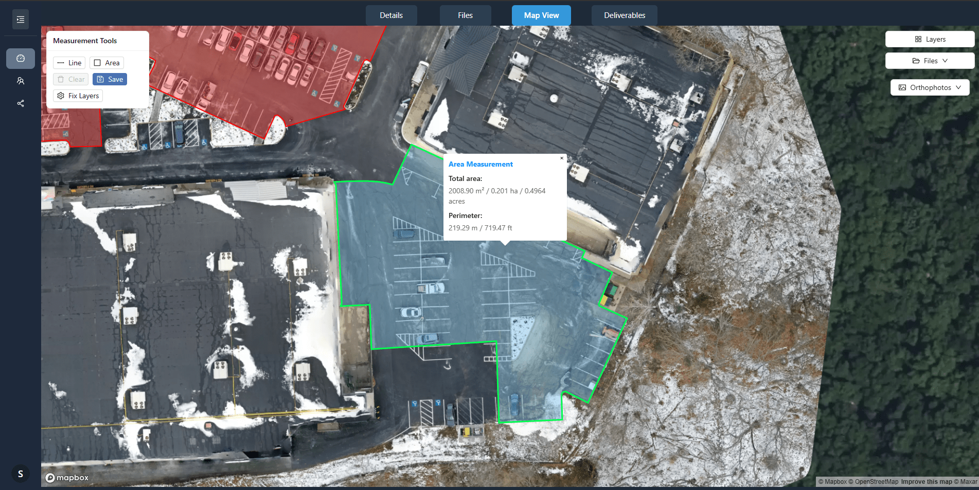
Site annotation tools allow users to mark up captures with notes, arrows, and measurements. These annotated images become part of the project documentation. They can be shared with the team, attached to reports, or filed for future reference. Over the course of a project, the collection of annotated orthomosaics forms a visual diary of construction from start to finish.
Change detection algorithms further automate the comparison. Instead of manually overlaying two images, software highlights areas where pixels differ beyond a threshold. This draws attention to new walls, removed debris, or altered terrain. The output is a map of changes that can be reviewed in minutes rather than hours.
For projects that span months or years, the accumulated drone captures provide a record that outlasts the construction team. Future maintenance crews, inspectors, or property owners can look back at how the structure was built. This long-term value is one reason why drone monitoring is becoming standard practice on large and complex projects.
